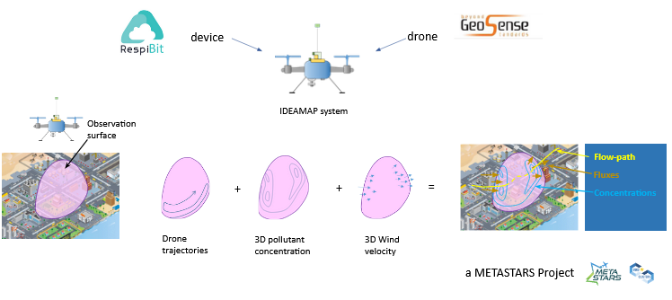
IDEAMAP
Intelligent Drones for Environmental Aerial Monitoring of Air Pollution
IDEAMAP Concept


IDEAMAP Technology
- Determination of local wind velocity vector by innovative hardware solution (provisional patent)
- A dispersed entity is mapped over a pre-defined surface in terms of its concentration and local wind velocity vector at specific locations
- Software then determines surface fluxes of dispersed entities which enable rapid determination of transfer (across surface), accumulation (within closed surface), and source detection (by back-tracking fluxes)
IDEAMAP Differentiation and Superiority
- Current solutions are ALL based on 4D representation (i.e., concentration and location) and are vastly inferior.
- 7D representation of dispersed entities is unique
- Only method that determines fluxes of dispersed entities
- Much faster detection of hot-spots and sources


IDEAMAP Vision
- Revolutionize the sector of air quality monitoring with IDEAMAP technology implemented in drone swarms.
- Defense applications: protection against chemical/bio warfare
- Aerospace applications: exploration for life on planets with atmosphere
What is IDEAMAP?
Is a joint project between RespiBit and Geosense – initiated under the METASTARS EuroCluster Project.
METAcluster Support Towards a more resilient AeRoSpace and defense ecosystem


